
Notes from a Curious Mind
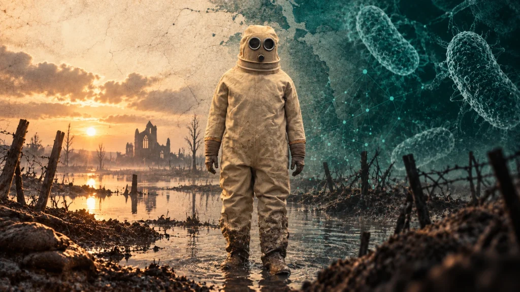
A strange suit, a flooded landscape and the diseases that followed war.
I should probably begin with a confession: 1914 is not ancient, not even close, so I am taking considerable liberties with the title Ancient Epidemics for this one.
While visiting the Brussels Air Museum with my daughter for a school project, I came across an object in a display case that I found impossible to ignore. It was a suit — a rather extraordinary one. Heavy and pale, with an enclosed hood and round viewing ports, it looked somewhere between an early diving suit and equipment from a science-fiction film. Yet its story belonged not to another planet, but to Belgium during the First World War.
And once I started reading about the landscape in which it was used, I realised that it belonged here too, because it tells us something important about the relationship between war, environment and disease.
A country engineered around water
The western corner of Belgium is unusually suited to a particular form of defence. Much of the landscape around Nieuwpoort is low-lying polder: land whose habitability depends upon careful management of drainage channels, dikes, sluices and tides.
By October 1914, the Belgian Army had fallen back towards the Yser under heavy German pressure, and the situation was desperate. The defenders therefore turned to the landscape itself. During a series of operations in late October, sluices around Nieuwpoort were manipulated to allow seawater onto the plain. The process was neither instantaneous nor simple — early attempts on the nights of 26–27 and 27–28 October let in too little water, and success depended heavily on detailed knowledge of the local hydraulic system. Only with a further attempt on 28–29 October did the water rise across a broad area between the Yser and the railway embankment.
The flood helped stop the German advance. A battlefield had effectively been transformed into a shallow inland sea, and there it largely remained.
Holding back an army with mud and water
The image of deliberate inundation can sound almost elegant when reduced to lines on a military map: open the sluices, flood the plain, stop the enemy. The lived reality was anything but elegant. The landscape became one of waterlogged fields, damaged infrastructure, mud, flooded positions and trenches dug in ground where the water table was never far beneath the surface.
The water itself had to be controlled throughout the war. From 1915, specialist Belgian engineers helped maintain the system, repairing and operating the hydraulic infrastructure that kept the inundation in place, and the flooding held until 1918. That is what made the suit in the museum so compelling. It was not simply protective clothing. It was evidence of people having to work inside an environment that war had deliberately made almost uninhabitable.
The other enemy
Popular memory of the First World War understandably focuses on artillery, machine guns, gas and the enormous casualties of battle. But soldiers also fought another enemy: their environment. Cold and persistent damp damaged skin and feet — trench foot alone is estimated to have caused around 75,000 British casualties. Sanitation was enormously difficult, rodents thrived around human habitation and food stores, and lice spread rapidly among men living in close quarters, driving roughly 800,000 recorded cases of trench fever in the British Army alone. Respiratory disease flourished in exhausted populations exposed to cold and poor conditions, and gastrointestinal infections remained a constant concern wherever sanitation and clean water failed.
The museum’s own display panel names the cost directly, in French, Dutch and English: bronchitis, pneumonia, typhus (1914–1916) and dysentery, the last tied to mosquitoes breeding in the stagnant water. These were not abstract risks. They were ones the army itself was tracking in real time, on the same information panel that describes the flood.
None of this was unique to the Yser. Indeed, it connects the First World War to a much older history: armies throughout history have frequently lost enormous numbers of people not simply to combat, but to infection. Campaigning brought together exactly the conditions microbes exploit — crowding, stress, malnutrition, wounds, contaminated water, poor sanitation and mass movement. This is why I think this admittedly non-ancient story belongs on Ancient Epidemics.
The weapons changed. The uniforms changed. The engineering became more sophisticated. But the biological vulnerabilities of human beings remained remarkably familiar.
When environments become weapons
There is another reason the Yser fascinates me. The environment was not merely where the war happened — it became part of the weaponry. Humans deliberately changed the hydrology of the landscape to create a military barrier, and that raises an uncomfortable historical theme that extends far beyond Belgium. Armies have destroyed crops, poisoned or denied wells, broken dams, drained marshes, flooded land, moved livestock and burned settlements. Each action may be undertaken for military reasons, but each can also alter disease ecology: destroy sanitation and enteric disease follows, displace populations and patterns of transmission change, flood farmland and humans, livestock, wildlife and contaminated water may suddenly interact in new ways, disrupt food systems and malnutrition weakens resistance to disease. War repeatedly demonstrates that health and environment cannot easily be separated.
The knowledge hidden in ordinary people
There is also something wonderful in the story of how the Yser was flooded. The operation depended not only upon generals and military engineers, but upon people who understood the landscape: Karel Cogge, a supervisor with the local water administration, and Hendrik Geeraert, a Nieuwpoort boatman, provided the knowledge crucial to manipulating the system of sluices and waterways — knowledge honoured after the war, Geeraert’s own portrait later appearing on a Belgian banknote.
It is a recurring theme in history. Formal authority may make decisions, but survival often depends upon people who know how a particular river behaves, where the ground floods, which plants can be eaten, how animals move or where clean water can be found. Local knowledge is not a picturesque addition to resilience. Sometimes it is resilience.
A museum cabinet
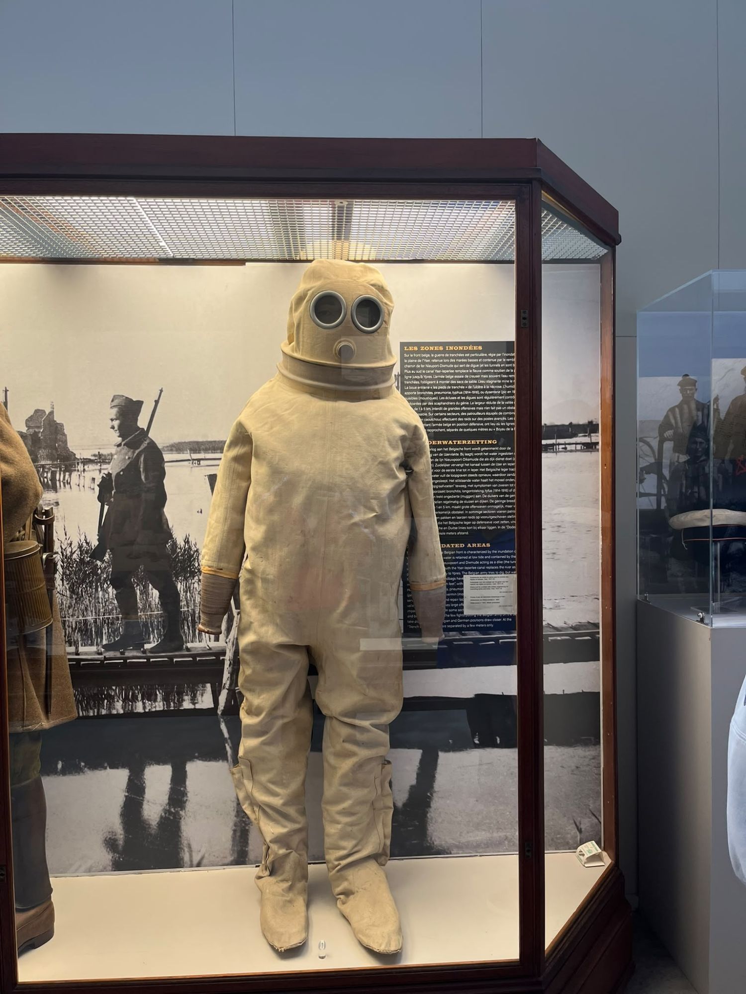
And so I came away from the museum thinking about a rather strange suit. Not an aeroplane, not a famous weapon, not the heroic image of an explorer or general — a rubber suit issued to the patrols who had to cross the flooded ground itself, raiding towards the enemy’s advanced posts across water that was never meant to be crossed on foot. Objects like this are useful because they bring history down to human scale. Somebody had to put that suit on. Somebody had to wade into the water. Somebody had to make it back. And behind the great movements of armies and arrows on maps were millions of people trying to stay warm, dry, fed and free from infection.
Perhaps that is why I found it so fascinating. It is not ancient. But the story it tells — of humans, water, disease, engineering and survival — is very old indeed.
If you’d like to keep up with pieces like this, the easiest way is to connect with me on LinkedIn.
References
- “The flooding of the Yser plain, October 1914.” Flanders Marine Institute (VLIZ). Read the paper
- “Belgium.” 1914-1918-online: International Encyclopedia of the First World War, Freie Universität Berlin. Read the entry
Key Takeaways
- In October 1914, the retreating Belgian Army deliberately flooded the low-lying polder plain between the Yser river and a railway embankment near Nieuwpoort, opening coastal sluices to let in seawater and halt the German advance.
- The operation took several attempts — two nights of insufficient flooding before a third, on 28–29 October 1914, succeeded — and depended on local hydraulic knowledge supplied by Karel Cogge and boatman Hendrik Geeraert, not military engineers alone.
- The resulting inundation was maintained by specialist engineers for the rest of the war, through 1918, turning the landscape into a permanent flooded, waterlogged battlefield.
- Disease and environmental hardship, not just combat, were major sources of WWI casualties: trench foot caused an estimated 75,000 British casualties, and lice-borne trench fever produced roughly 800,000 recorded cases in the British Army alone.
- Deliberately altering an environment for military advantage — flooding land, poisoning wells, destroying sanitation — has repeatedly reshaped disease ecology throughout history, connecting a 1914 battlefield to a much older pattern of war and infection.
Questions & Answers
Why did Belgium flood the Yser plain in 1914?
To stop the advancing German Army during the Battle of the Yser. Belgian forces opened coastal sluices near Nieuwpoort at high tide, letting seawater flood the low-lying polder land and creating a water barrier the Germans could not cross.
Who made the 1914 Yser flooding possible?
Karel Cogge, a supervisor with the local water administration, and Hendrik Geeraert, a Nieuwpoort boatman, supplied the detailed local hydraulic knowledge needed to manipulate the sluices — knowledge that formal military planning alone did not have.
Was disease a major cause of death in the First World War?
Yes. Alongside combat, poor sanitation, cold and damp conditions caused enormous non-combat losses — including an estimated 75,000 British trench foot casualties and roughly 800,000 recorded cases of lice-borne trench fever in the British Army alone.
Is this article really about an "ancient" epidemic?
No — the author says so directly. It's included because the underlying pattern (war deliberately reshaping an environment, and that reshaping altering disease risk) connects a 1914 battlefield to a much older and recurring theme in history.